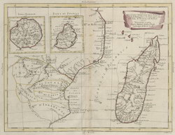
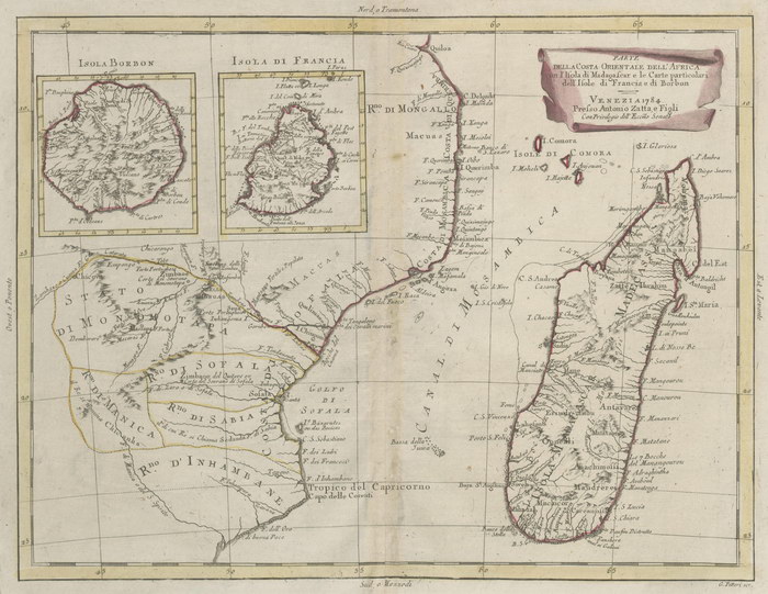
Parte della Costa Orientale dell'Africa
con I'Isola di Madagascar e le Carte particolari dell'Isole di Francia di Borbon
|
[Part of the East Coast of Africa with the Island of Madagascar and Detail Maps of the Isles of France and Bourbon]
|
Unpublished reproduction (2006). (First Published 1784)
|
|
Single Sheet
A colour reproduction of a map of Madagascar and the east coast of Africa published by Presso Antonio Zatta, Venice in "Atlante Novissimo" (1779-1785). There are larger scale insets showing Isola Bourbon [Reunion] and Isola di Francia [Mauritius].
|
Notes
|
- This reproduction is roughly 65% of the size of the original, which measures 384mm x 289mm. The scale of the original is approximately 1:7,000,000.
- Replicated from a map in the collection of the National Library of Australia.
|
Condition of Item
|
|
Fine.
Refer to the glossary for definitions of terms used to describe the condition of items.
|
Categories
|
|
|