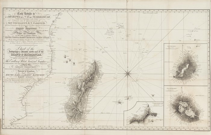
Carte Réduite de l'Archipel du N.E. de Madagascar / Chart of the Archipelago or Islands north east of the Island of Madagascar
Corrigée sur les observations les plus récentes / Corrected according to the latest observations
|
|
|
Unpublished reproduction (2006). (First Published 1819)
|
|
Single Sheet
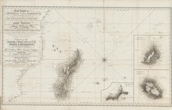
A colour reproduction of a map of the Indian Ocean, including Madagascar, by Jean Baptiste Lislet-Geoffroy. Published by A. Arrowsmith, London. There are larger scale insets showing the islands of Mauritius, Isle de Bourbon [Reunion], and Isle Mahe (the largest in the Seychelles).
|
Dedication (French / English)
|
|
Dressée sous le Gouvernement de Son Excellence, R. T. Farquhar, Gouverneur, Commandant en Chef, Capne. Général de l'Ile Maurice et dépendances, Vice Amiral, &c&c&c; par Lislet Geoffroy, correspondant de l'Académie Rle. des Sciences de Paris, de la Société d'Emulation de l'Ile Maurice. Dédiée avec Permission au très noble et Puissant Seigneur Henri, Comte et Baron Bathurst, Baron Apsley; Pair du Parlement d'Angleterre, Conseiller du Roi en son Conseil privé, Principal Secrétaire d'Etat de sa Majesté Britannique ayant le département de Guerre et des Colonies, Chevalier de l'Ordre très noble de la jarretière &c&c&c.
Drawn up under the Government of His Excellency Robert Townsend Farquhar, Governor, Commander in Chief, Captain General of the Isle of France and dependencies, Vice Admiral, &c&c&c; by Lislet Geoffroy, Member of the Society of Emulation of the Isle of France, Correspondent of the Royal Society of Sciences of Paris, &c&c&c; and Dedicated by Permission to the Right Honourable Henry, Earl and Baron Bathurst, Baron Apsley, Peer of Parliament, one of the King's most honourable Privy Council, His Majesty's principal Secretary of State for War and Colonies, Knight of the Garter, &c&c&c.
|
Note (from Beneath the Map)
|
|
Engraved under the direction of A. Arrowsmith, 10 Soho Square, 1819.
|
Notes
|
- This reproduction is roughly 30% of the size of the original, which measures 974mm x 570mm (folded to 230mm x 290mm). The scale of the original is approximately 1:5,000,000.
- Replicated from a map in the collection of the National Library of Australia.
|
Condition of Item
|
|
Fine.
Refer to the glossary for definitions of terms used to describe the condition of items.
|
Categories
|
|
|