Islands of the Indian Ocean
|
|
|
Unpublished reproduction (2006). (First Published 1851)
|
|
Single Sheet
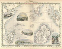
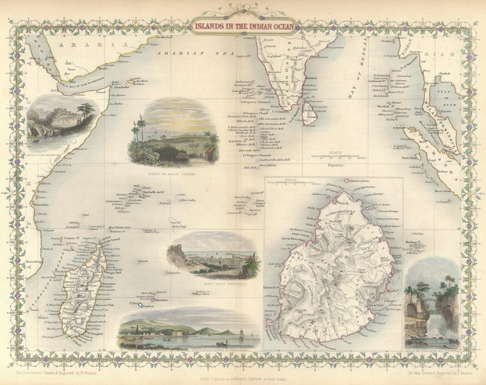
A colour reproduction of a map of the Indian Ocean, including Madagascar, by John Rapkin. There are also five colour illustrations drawn and engraved by H. Winkles. Originally appeared in "The Illustrated Atlas, And Modern History Of The World Geographical, Political, Commercial & Statistical" edited by R. Montgomery and published by John Tallis & Company. There is a larger scale inset of Mauritius.
|
Notes
|
- This reproduction is roughly 65% of the size of the original, which measures 384mm x 289mm. The scale of the original is approximately 1:7,000,000.
- Replicated from a map in the collection of the National Library of Australia.
|
Condition of Item
|
|
Fine.
Refer to the glossary for definitions of terms used to describe the condition of items.
|
Categories
|
|
|