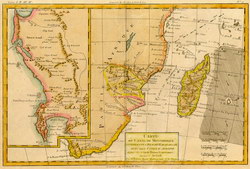
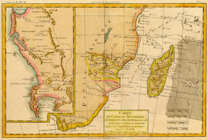
Carte du Canal de Mosambique
contenant l'Isle de Madagascar avec les Côtes d'Afrique, depuis le Cap de Bonne Esperance jusqu'a Melinde
|
[Map of the Mozambique Channel: including the Island of Madagascar with the African Coast, from the Cape of Good Hope to Malindi]
|
Unpublished reproduction (2006). (First Published 1780)
|
|
Single Sheet
A colour reproduction of a map of Madagascar and part of the East African coastline by Charles-Marie Rigobert Bonne (1727-1794), Royal Hydrographer of France. This map originally appeared in his Atlas Maritime in 1762 but this edition is from Atlas Geographique... à L'Histoire. It was engraved by André.
|
Notes
|
- This reproduction is roughly 90% of the size of the original, which measures 312mm x 202mm on a sheet 368mm x 245mm. The scale of the original is approximately 1:23,000,000.
- Livre I, II, III, IV; no. 11.
- Replicated from a map in the collection of the University of Florida Library.
|
Condition of Item
|
|
Fine.
Refer to the glossary for definitions of terms used to describe the condition of items.
|
Categories
|
|
|