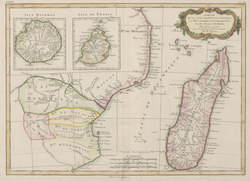
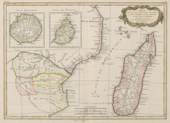
Partie de la Côte Orientale d'Afrique
avec l'Isle de Madagascar et les Cartes particulières des Isles de France et de Bourbon
|
[Part of the East Coast of Africa with the Island of Madagascar and Detail Maps of the Isles of France and Bourbon]
|
Unpublished reproduction (2006). (First Published c.1783)
|
|
Single Sheet
A colour reproduction of a map of Madagascar and the east coast of Africa by Rigobert Bonne (1727-1794). This is plate XXXIII probably from "Atlas Moderne, ou Collection de Cartes sur Toutes les Parties du Globe Terrestre". There are larger scale insets showing Isle Bourbon [Reunion] and Isle de France [Mauritius].
|
Notes
|
- This reproduction is roughly 68% of the size of the original, which measures 390mm x 275mm. The scale of the original is approximately 1:7,000,000.
- Replicated from a map in the collection of the National Library of Australia.
|
Condition of Item
|
|
Fine.
Refer to the glossary for definitions of terms used to describe the condition of items.
|
Categories
|
|
|